Thanks a lot Alberto, very useful! And welcome Giuseppe!
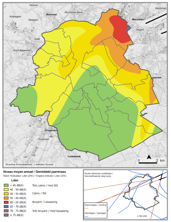
The map inspired me to look up noise pollution from air traffic. Below is a copy from 2016, more maps can be found here: https://environnement.brussels/thematiques/bruit/donnees-bruit/cartographie-et-exposition-de-la-population/cartographie-du-bruit-du
Oh man! And then my Inner Nerd broke loose  . Ready?
It turns out that Bruxelles Environnement produces quite a lot of maps as a matter of fact.
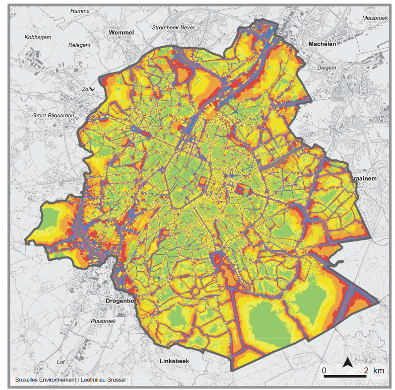
This is noise pollution from road traffic:
Air pollution seems more difficult to find though. There are a couple of websites that offer real-time data on PM and NO2, but nothing that is compatible with my (very limited) IT skills.
This one does not have a legend, but seems to provide a good overview:

Source: Zone de basse émission : une mesure nécessaire mais insuffisante – ARAU
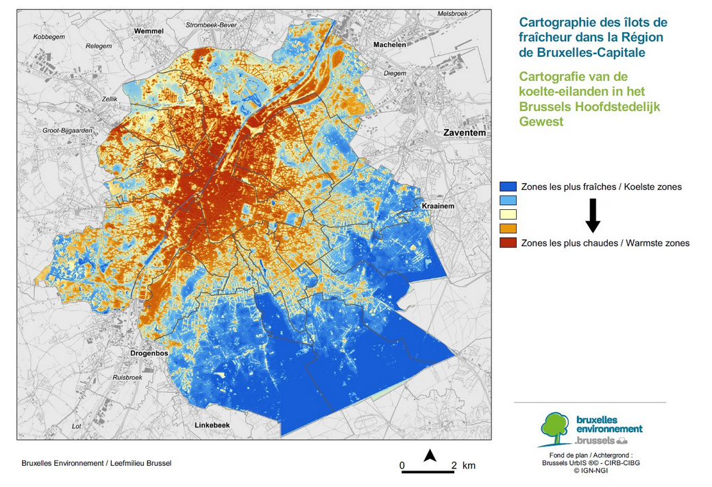
And then finally - nothing we didn’t know already, but just for the sake of future-proofing - warmest and coldest areas:
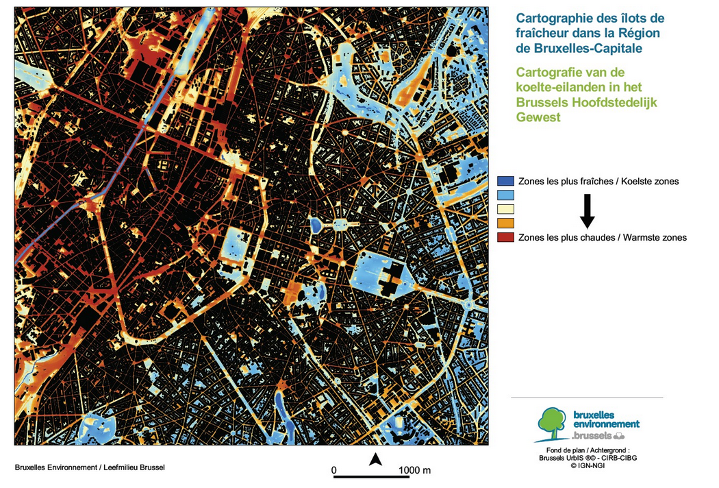
The more interesting part about this one is a more detailed zoom, which shows the impact of green spaces, not only parks but also blocks within streets that have a lot of trees:
Source: Bruxelles-Environnement dévoile une carte des zones les plus chaudes de la Région bruxelloise - BX1
So that! Lots of maps! Let’s maybe get together soon-ish again?
Cheers!