I have been something of a climate refugee the past couple of weeks. As many of you know, this is a record-setting year for wildfires in the western USA and particularly California and Oregon. I live on the north coast about a 3 hour drive from San Francisco. I have an option of staying in this house, going south a couple of hours where my kids live or heading east into the mountains where my family owns a small cabin by a river.
How tolerable any of these places are depends mainly on the wind direction and strength. Last week the wind drove so much smoke up the coast that I retreated to the mountain place. A few days ago the wind shifted and reversed so that the air in the mountains became dangerous and the air on the coast is ok.
So yesterday I crossed the state and returned home. It was not until I got quite close to the coast that the air showed any blue at all.
These wildfires of epic proportions are now standard out here. This year already broke the record for total acreage burned by 50% and the largest fire in California history continues to burn on the other side of this county. If the wind shifts again, I will be out of here seeking better air.
What is different this year is how much better the Internet tools are in showing what is happening and what is likely to happen.
There are several websites that show the details of each big fire in visual and text form. The main one for the country is InciWeb (https://inciweb.nwcg.gov/). Not a new site, but one that continues to improve. And there is this newer site, WiFire (https://firemap.sdsc.edu/) that gives an excellent graphic visual of the various fire perimeters.
Air quality can be monitored by a marvelous citizen-science site, Purple Air (Real-Time Air Quality Map | PurpleAir). This is a cluster of air quality sensors that report constantly back to the site. It offers a range of indexes to check to see if large or small particulate matter is in the air. This site ought to win some sort of award.
And I can check wind direction and speed, with an ability to look at future wind prediction at WIndy.com (Windy: Wind map & weather forecast).
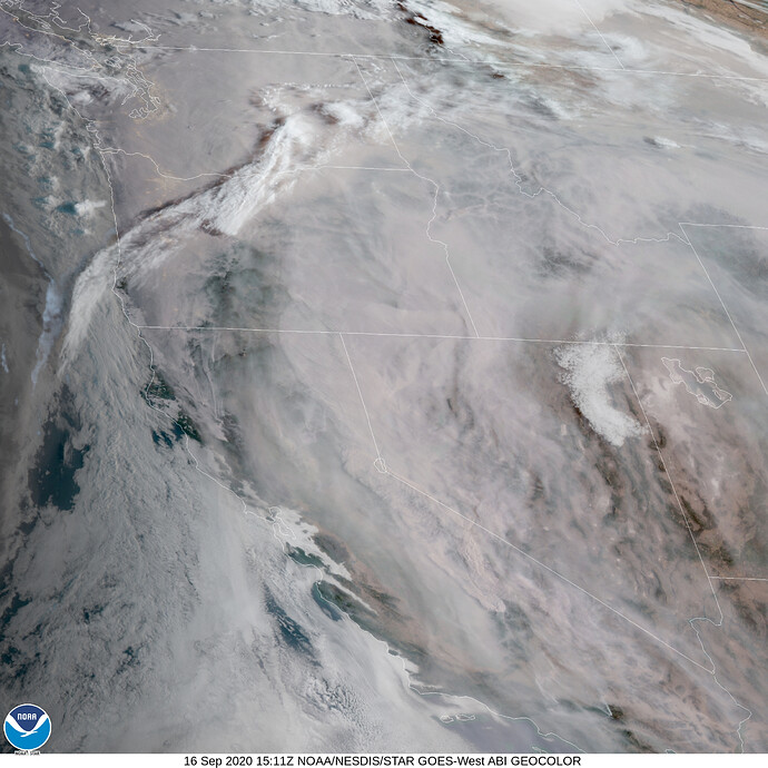
And I can look at satellite views of the air/smoke content at the NOAA government site, forecast.weather.gov (National Weather Service). Here is a satellite shot taken a few minutes ago:
You can see that the west is under a blanket of smoke but the coast has some blue areas. I monitor all of these sites during the day and night.
So, for all the talk about fake news, bad info, social media rotting our brains and all (and last night I watched “The Social Dilemma” on Netflix, which I highly recommend), it needs to be said that essential tools for citizens to know what is happening in the natural environment without waiting for the news to report it, continues to improve to where one now can have a useful toolkit for making crucial decisions.
Thus, I think a “Net Generation Internet” should put resources into making such tools better and more available. Obsessing about Facebook and Amazon and other monopolies is important and necessary, but it is still not the whole picture and hopefully never will be.
